Step 1. Google Earth
|
|
If not already installed, download and install Google earth from the Google Earth Download page.
Hint: To speed up the download, exclude Google Chrome by unchecking the checkboxes.
|
|
Google Earth will be used to view satellite and land contour images of your location.
You'll be able to view the hills and mountains and plot a line of site path between a marker at your location to a marker at the cell tower location. |
Fly to Your location
|
|
|
Some settings changes
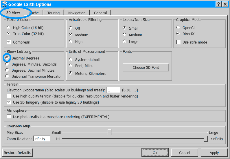
1.1 Google Earth >> Tools >> Options
|
|
Configure to display Latitude and Longitude in Decimal Degrees.
|
Stop GE from automatically tilting the view as it zooms. |
 |
 |
| |
|
|
Find your GPS coordinates & mark your location
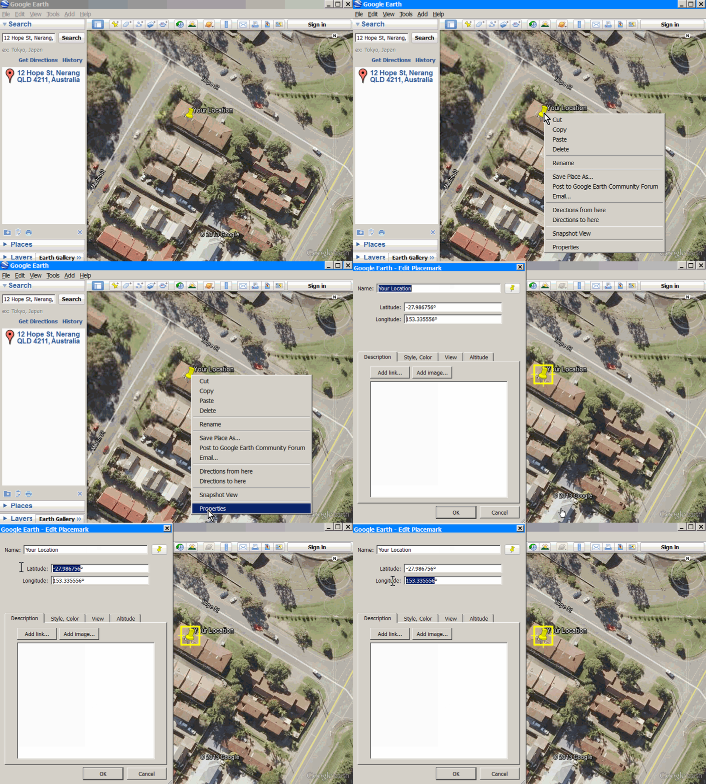
1.2 Drop a marker at your location.
|
|
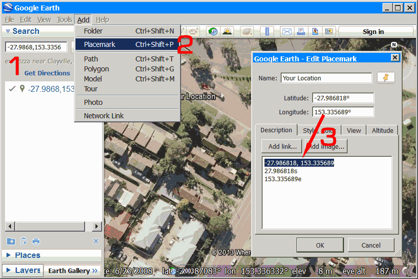
1 - Paste the Lat/Long coordinates, Press [Search]
2 - Drop a marker near your location and drag it to the exact position your antenna will me mounted.
Press [Add], [Placemark]. , Name your Placemarker for future reference.
|
 |
3 - Highlight the Coordinates without the "°" and to copy to the notes box, as shown above.
This can make for easy copy/paste in a later step. |
 |
4 - Highlight the [Lat, Long] Coordinates and to copy. see 3 in the above image.
|
|
|
|
 1.3 Leave Google Earth open. 1.3 Leave Google Earth open.
You'll be using this later, so minimize or re-size without closing it.
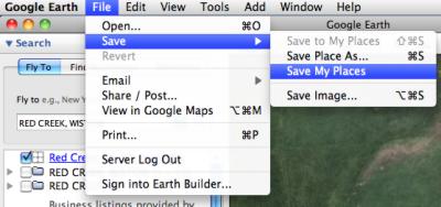
1.4 Save your work.
Its a good idea save your place-mark by clicking
"Save my Places" on the "File, Save" menu of Google Earth.
This saves all your work in Google Earth, so if your PC or Google Earth crashes while your doing this research, you wont need to start all over again.
|